EXCAVATIONS AT ORANMORE
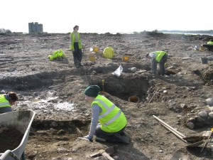
This is the first of a series of posts on the exciting results of excavations carried out by Moore Group at Pairc and Clochair, Oranmore, County Galway between 2008 and 2010. A number of sites were excavated in advance of construction of a new supermarket and associated access and other services.

Today we’ll describe the results of excavations at Area 1.
The site at Pairc an Clochar comprised a number of green fields to the south of the Oranmore river at the mouth of Galway Bay. Two recorded monuments are in close proximity to the proposed development area. RMP GA095-111, a church and graveyard, lies to the south of the site and the north wall of this church forms part of the boundary wall for the development. To the southwest of the site is Oranmore Castle, a familiar Galway landmark; RMP GA095-110 is a tower house. The protrusion of bedrock through the soil in many areas is indicative of the shallow soil depth. Archaeological testing confirmed that in many areas soil cover amounted to little more than a thin layer of sod over bedrock.
Previous work within the subject area was carried out in 1999 as part of the Oranmore Main Drainage scheme. This work was archaeologically monitored at the time and no features of archaeological interest were identified along the portions of this scheme which run through the proposed development site.
Area 1 was located on the northern side of the ruined church site RMP GA095:111. The Old Church was a ruin in the 1830’s when it was surveyed during the first Ordnance Survey. While the construction date of this church is unknown it is believed to pre-date the sixteenth century reformation, and is likely to have been converted to Protestant worship at that time. This monument lies immediately beside the development site, with the north wall of the church actually forming a field boundary with the development. Evidence of human burial was recovered from the topsoil throughout the site in the form of disarticulated human remains. These remains were in a very poor state of preservation and had obviously suffered extensive damage as a result of land use throughout the years. Below the topsoil in the northern portion of the site two extended skeletons were found in situ though both were in a poor state of preservation. In the south of the site the badly disarticulated remains of a neo-natal inhumation were also identified. In the rubble layer – collapse from the adjacent church – further human remains were identified mixed throughout the rubble and in three separate areas inhumations were identified partially covered by, and extending under this rubble layer.Following consultation with the Department it was decided to excavate both adult inhumations in the north of the site as well as the neo-natal remains. These burials were sitting on the glacial till and were not protected from possible damage by anything more than 0.05-0.15m of sod cover. Those burials contained within and under the stone rubble layer were preserved in situ, protected as they were by a layer of collapsed stone.
Human skeletal remains can provide a wide range of information, e.g. demography, sex and age profile, stature and diseases. Furthermore the analysis can provide details of diet, occupation, general state of health and traumas caused to individuals. During the analysis it is important that the methods used are standardised to allow for comparisons to be made, both between individuals in the same material but also between different populations, different sites and materials from different points in time.
All three burials were running in an east to west direction with burial 3 located a short distance away from burial 1 & 2. The three burials represents the remains of one adult (age-at-death between 33-50 years), one child of between 8-12 years and one infant (<1 year).
The inhumations excavated in the north of the site were both in poor states of preservation. The northernmost burial was buried in a prone position and orientated east/west. A copper alloy buckle with pin fragment attached was found in the topsoil covering Area 1 which we’ll describe in the next post and another notable find from Area 1 was a small silver coin which was found with Burial 1 which will be described in the post after that…..
This entry was posted on Friday, February 4th, 2011 at 2:34 pm. It is filed under About Archaeology, Papers & Reports and tagged with Archaeological excavation, Archaeologist, galway, Oranmore.
You can follow any responses to this entry through the RSS 2.0 feed.


[…] Pictured above is the coin recovered from the site at Oranmore – you can read the introduction to the excavation in this post: http://www.mooregroup.ie/2011/02/excavations-at-oranmore/ […]