Here’s some Humpback Whales cavorting in Monterey Bay last week; Recorded while ‘adventurising’ in the US.
Found throughout the world Humpbacks (Megaptera novaeangliae) feed mainly on Krill, a type of shrimp-like marine crustacean (from the Norwegian word krill meaning “young fry of fish”) and other small fish. The Humpback is a Baleen whale, typically identifiable by it’s knobbly head and long pectoral fins. As can be seen from the video it’s quite an acrobatic animal often to be seen slapping the water.
Humpbacks are also found around the coast of Ireland, generally heading north in Summer to feed in the nutrient rich polar waters, or heading south in the Winter to their tropical breeding grounds, during which period they live off their fat reserves. For more info on Whales in Irish waters see enfo’s site here.
Like other large whales, the humpback was and is a target for the whaling industry. In Irish waters, Norwegian whalers continued taking minke whales until as recently as 1976, when the Wildlife Act gave full protection to all our cetaceans, making whaling illegal in our waters.
The California trip did have a serious work related purpose, however – namely training up in the use of our new Hydrographic system.
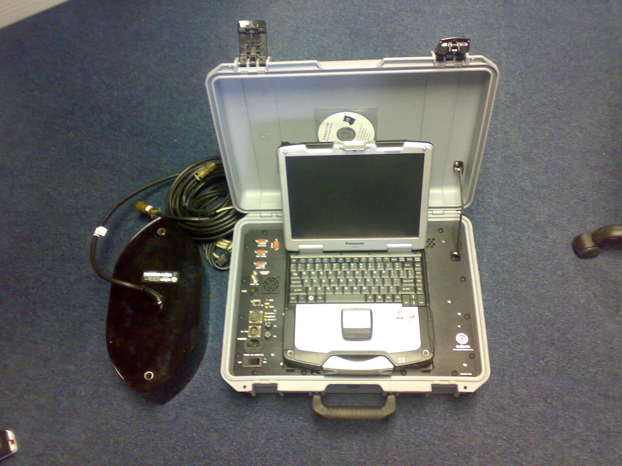
We’ve just taken delivery of a new Odom Echotrac Hydrographic System (pictured below). This system will allow us to carry out detailed bathymetric surveys of rivers, lakes and the open sea. The ODOM system is highly portable and can operate in water depths as shallow as 0.2m. It can operate concurrently on two frequencies (one high and one low) and can also offer limited subsurface penetration. Data acquisition of the system can be carried out either through Odom’s own software or our own Hypack software.
The system will be very useful to clients for both archaeological and environmental surveys as it will generate 3 dimensional drawings of underwater survey areas. We already have a number of test runs organised for the unit. These will include Lough Atalia in Galway and portions of Kinsale Bay. We’ll post the results here in due course.
[…] etc.., to survey the condition and status of underwater cables, and in combination with our ODOM bathymetric survey system and other surveying techniques such as sub bottom profiling and magnetometer surveys (using […]


[…] etc.., to survey the condition and status of underwater cables, and in combination with our ODOM bathymetric survey system and other surveying techniques such as sub bottom profiling and magnetometer surveys (using […]